Why every World Map is Wrong?
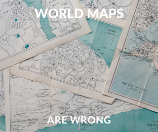
Most people's perceptions of the actual size of countries across the world are wrong. And most of the reason is because we're used to seeing this world map all the time, like literally all the time, Google Maps, Apple Maps, and classrooms all across the world use this map, and it's not entirely representative of the true size of actual countries. So let's get started first with islands. I think it's fascinating to look at an actual size comparison side by side of the world's 15 largest Islands, which in order are Greenland New Guinea, Borneo, Madagascar, Baffin Sumatra, Honshu, Victoria, Great Britain, Ellesmere Sulawesi, the South Island of New Zealand and Java, the North Island of New Zealand and Finland. Now there's a lot of interesting stuff to unpack here. First off, let's look at the populations on all of these islands. Some of them like bath and Victoria and Ellesmere, despite being huge, are almost uninhabited while Java, Honshu, and Great Britain are all incredibly crowded comparison, the relatively small island of Java has more people living on it than the entire population of Russia, but their size differences is pretty drastic. Great Britain is a lot smaller than both the islands of New Zealand when they're combined. Despite Great Britain is home to over 60 million people. New Zealand, not even being home to 5 million, but that's nothing when compared to Japan. New Zealand is roughly the same size but Japan is home to almost 127 million people 25 times more than the number of people in New Zealand and Japan itself is pretty huge. Here's what it looks like just off the east coast of the United States where you can see that it stretches from Maine all the way down to Cuba or from a European perspective. Japan stretches from St. Petersburg in the north to Tupelo Sardinia in the south, but Japan is actually quite small when compared to the size of Indonesia, which will probably be bigger than your thoughts. For starters, here's Indonesia's actual size placed over the United States and the distance from one side over to the other is actually greater than the distance across the entire continental US and for a European perspective, the distance across Indonesia is greater than the distance of Ireland from Uzbekistan, or for another perspective, here is Indonesia when compared to Russia, Indonesia is really, really big. But there are other weird unexpected Island geographies out there too. For example, let's take the Republic of Ireland and South Korea, you may think that finding a similarity between them would be really difficult, but you might change your mind when we overlap their borders with one another. Ireland and South Korea have very similar shapes and sizes despite Ireland having a population of only 4.8 million and South Korea has a population of over 51 million. So while they may be similar in size, they aren't in the name. Two places that are though are Georgia and Georgia, Georgia the state is more than twice as big as Georgia, the country and with almost three times the population as well. With that in mind, I think if Georgia ever got into a fight with Georgia, I think that Georgia would most likely win out now in my last video, I talked about how much bigger Africa is than most people seem to think it is. But I didn't talk about individual African countries and their sizes. Somalia immediately jumps to mind first because well it's a really big place over the US in actual size. Somalia stretches up from Detroit in the north down to Florida in the south and spans basically the entire East Coast from the European perspective. Somalia stretches from London through Germany and France before finally hitting Valencia in Spain but there are other big African countries to Kenya is almost the same size as Texas in the United States are weirdly similar and shaped the old borders of the Holy Roman Empire when placed over Europe. But none of these compare to the Jupiter of Africa, the Democratic Republic of the Congo, which really is massive in every sense. Of the word placed over America. The DRC stretches from Miami in the south juts out past Dallas in the west and all the way up above Chicago and getting even into Canada up in the north placed over Europe. instead. The DRC stretches from the south of Greece to Spain in the west and up to Belarus, Lithuania, and Denmark. Up in the north, the DRC and Africa alone take up a significant part of an entire continent and land area but we're still not done. Next up. We have to spend some time talking about Chile, Chile is well it's long, very long, so long. In fact, If you flipped it on its side you could nearly span the entire length of the US Canadian border with it. If you moved it over a bit. You could also span the entire Atlantic Ocean from Canada to Paris. If you placed a CI laid back to normal but kept it in Europe. It would stretch from the top of the continent of Norway all the way down beneath Crete and near Libya in south Chile is there for taller than Europe is higher continents, which is kind of one of the main points that I'm trying to make in this video. Europe is a lot smaller than most people think it is traveling across Europe can take you through multiple languages and cultures in a short amount of time which can give the illusion of a bigger size. But don't be fooled to put into perspective just how much bigger the lands were that European empires went out and conquered and subjugated in the centuries past. Here are a few examples the Indian subcontinent once ruled entirely by Britain. is almost as big as Europe is itself and takes up almost every country west of Ukraine and Romania. And that wasn't even the only massive British possession. Let's take Australia, a genuine continent in its own right. That pretty much does cover all of Europe from Portugal to Moscow and from Turkey to the Norwegian Sea. The Continental US over Europe is basically also the same size as the continent stretching from Portugal in the West to a little beyond Moscow in the east, but we're not done yet making Europe feel like a tiny place. Let's take Brazil next which like the others before this basically spans most of the entire continent as well. Seriously, just stop and look at this for a moment. You can fit practically all of Europe inside of Brazil and it was ruled for centuries by just this tiny little nub here at the end, and this is why Brazilian Portuguese is more widespread than Portuguese, Portuguese. Anyway, none of these really compared to what in my opinion is the biggest shocker in this list, which is China when placed over Europe. China's gargantuan size is truly understood by most of us in the West for the first time. China pretty much is the size of Europe, except it's all ruled by a single government. Its population is roughly double the size, and it's over 91% made up of the same cultural and ethnic group. In short, from a European slash western perspective. The world is sometimes shown to us from our point of view, which makes our countries or our continents seem much bigger than they actually are. The fact is the world is a huge place and the West is just a small part of it.


Comments
Post a Comment